Month: July 2016
Real Time Information on Irrigation: Telangana to tie up with ISRO
A first of its kind water resources monitoring system is set to come into effect in Telangana with the irrigation department joining hands with the Indian Space Research Organisation (ISRO) and setting up the Telangana Water Resources Information System (TWRIS). The new system will be set up by ISRO’s National Remote Sensing Centre.
Information on water availability and cropping pattern in all irrigation systems throughout the State can be had on the mobile phone. Soon, everyone from citizens to farmers, administrators and policy makers can gain access to information about water availability and cropping pattern in all irrigation systems throughout Telangana on their mobile phones along with satellite maps.
While the mobile app is still in the developmental stage, the Irrigation and Command Area Development (I&CAD) Department is getting ready to build an exclusive Telangana Water Resources Information System (TWRIS) portal with the help of the National Remote Sensing Agency (NRSA) for a holistic geospatial data base for the total irrigation system.
Geospatial data
The NRSC through Cartosat satellites will be providing geospatial technology support from the Bhuvan geo-platform with necessary tools and interfaces. Geospatial data on natural resources, drainage, water bodies, etc., generated from different sources, will be published and enabled for online access through the portal for use by the department. “We will be the first State to geo-tag all the major, medium and minor irrigation projects, canals system, command areas with boundaries and project details with help of satellite imagery to be updated once every fortnight,” explains Commissioner of Command Area Development Authority Dr. G. Malsur.
Cropping pattern
The portal, which will initially be made accessible to the irrigation department officials, is being designed to provide information about water availability in any given project at a given point of time, data related to cropping pattern, whether it is a single crop or double crop for kharif/rabi, drought intensity, total irrigated area etc., for every cropping season. “We will also be in a position to know the irrigation potential utilised, the ayacut gap in the command area and whether there is any overlap of the command area,” he says. Icrisat (International Crops Research Institute for Semi-Arid Tropics) has also been roped in for information about the cropping patterns and irrigated area mapping with details of canal or well or ground water or rainfed. The NRSC will be maintaining the portal and also train officials for using the portal and satellite data based irrigation management applications, in facilitating data generation and verification.
ISRO scientific secretary PG Diwakar and other members made a powerpoint presentation to irrigation minister on Friday on how the proposed WRIS system will function. Through, the initiative, the irrigation department will update photos of tanks, water bodies and projects regularly with the help of satellite images. Harish Rao wanted ISRO officials to provide the data of tanks before and after renovation works taken up under the Mission Kakatiya scheme.
“Satellite photos will not lie and this will be useful to assess the work done under Mission Kakatiya,” official sources said. “Water levels at reservoirs with satellite photos will be updated to the proposed website once in 15 days,” sources said.
NASA-ISRO SAR Mission (NISAR)
A dedicated U.S. and Indian InSAR mission, in partnership with ISRO, optimized for studying hazards and global environmental change.
The NASA-ISRO Synthetic Aperture Radar (NISAR) mission is a joint project between NASA and ISRO to co-develop and launch a dual frequency synthetic aperture radar satellite. The satellite will be the first radar imaging satellite to use dual frequency and it is planned to be used for remote sensing to observe and understand natural processes of the Earth.

ISRO will be responsible for design and development of S-band SAR, Spacecraft Bus, data transmission system, spacecraft integration and testing. The radar will be launched using the Geosynchronous Satellite Launch Vehicle (GSLV) and ISRO will also be responsible for the in-orbit operations, Minister of State in the PMO Jitendra Singh, who also holds charge of the Space Department, told the Rajya Sabha in a written reply on July 21, 2016. The project is slated to be completed and launched by 2021, parliament was told on Thursday.
Using advanced radar imaging that will provide an unprecedented, detailed view of Earth, the NASA-ISRO Synthetic Aperture Radar, or NISAR, satellite is designed to observe and take measurements of some of the planet’s most complex processes, including ecosystem disturbances, ice-sheet collapse, and natural hazards such as earthquakes, tsunamis, volcanoes and landslides.
Data collected from NISAR will reveal information about the evolution and state of Earth’s crust, help scientists better understand our planet’s processes and changing climate, and aid future resource and hazard management. The mission is a partnership between NASA and the Indian Space Research Organization.
Scientific Instrument(s)
– L-band (24-centimeter wavelength) Polarimetric Synthetic Aperture Radar
– S-band (12-centimeter wavelength) Polarimetric Synthetic Aperture Radar
In what’s being termed a first of its kind endeavour, NISAR will be able to operate in two frequencies, both in bands lower than KU-Band or AA-Band. While Isro will take care of the S-band radar, expected to have a 12-cm wavelength, Nasa will supply the 24-cm wavelength L-band radar.
Drone-Based Agricultural Technology
The Indian government has launched a collaborative research project involving use of drone technology in farming sector for assessing quality of soil and compensation for losses due to flood, the Ministry of Agriculture said in a Lok Sabha query. The project aims to implement Hyperspectral Remote Sensing using drone systems and developing a locally researched prototype for soil health monitoring and integrating it with satellites for large scale agricultural applications in the future.
Drones will soon be seen scouting over farm fields in India, gathering required geographical data using sensors, pictures, etc. and transmitting such information in real time. This technology will be used primarily in farming sector at regional/local levels for assessing land and crop health; extent, type and severity of damage, issuing forewarning, and settlement of compensation under crop insurance schemes.

Drone technology based unmanned aerial vehicle (UAV) has ability for smooth scouting over farm fields, gathering precise information and transmitting the data on real time basis. This capability could be used for the benefit of farming sector at regional/local scale for assessing land and crop health; extent, type and severity of damage besides issuing forewarning, post-event management and settlement of compensation under crop insurance schemes.
The Indian Council of Agricultural Research (ICAR) through the Indian Agricultural Research Institute (IARI) has formulated a collaborative research project entitled “SENSAGRI: SENsor based Smart AGRIculture” involving six partner Institutes (Agriculture & IT) to be funded by Information Technology Research Academy (ITRA), Department of Electronics and Information Technology (DEITY), Ministry of Communication and Information Technology (MCIT), Govt. of India and ICAR.
Laser Scanning Technology
Reality capture is no longer the future of 3D conceptual modeling – it’s the present. This is good news for beginners and experts alike in the conceptual modeling, building, and renovation sphere, as 3D imaging technology is now more user-friendly and accessible than ever before.
Reality capture allows you to create 3D models of real-world objects that you can edit, annotate, and measure. By working with landscapes, construction sites, and designs in the virtual world before executing on them in reality, your projects become smoother, safer, and more efficient. Not to mention, companies see a huge ROI when applying these tools to their projects.

There are two main workflows used to create reality data:
- Photograph-based data requires you to take photographs of real-world scenes (usually for surveying landscapes or construction sites) to create reality data/ a virtual model. The industry term used to describe this process photogrammetry or the turning photos into point clouds.
- Laser-scan based data involves taking laser scans of a landscape or building and uploading them to reality computing software. This process is often used for renovation and construction projects.
Once you’ve captured photographs or laser scans of the object you want to model, Autodesk’s ReCap 360 Pro can automatically stitch the files together to create a high-resolution model such as a point cloud or a textured mesh. These models are optimized for use in other hero products by Autodesk, like AutoCAD, Revit, and Infraworks. If you’ve captured a landscape, you can create an orthographic view and add geographic points to your data to more accurately measure it. The benefits of this are far-reaching, including:
- Collecting as-built data of a site
- Avoiding costly rework requests by updating your client with visuals of your progress
- More accurately measuring your building materials and assets on-site
- Making sure assets arrive on-time and are delivered to the right location
- Providing clients with updates throughout a project, so you can invoice at milestone markers rather than all at once at the end of a project
In the conceptual modeling sphere, reality capture allows you to design within the context of the surrounding landscape. For example, Red Rocks Amphitheatre, located just outside of Denver, Colorado, is flanked by natural rock face that would be impossible to document by hand. However, one team was able to capture the historic site through aerial imaging by attaching a GoPro to a drone and flying over the site. With the contextual landscape, they were able to document the landscape so it can now be monitored and preserved, and stage engineers have the ability to test sound and lights virtually before the show.
Mapping Singapore in 3D
Bentley Map is instrumental in Singapore Land Authority’s production of 3D map data and city model for all of Singapore – more than 700 square kilometers. Singapore Land Authority employed multiple rapid mapping technologies such as oblique imagery, airborne laser scanning, mobile laser scanning, and terrestrial scanning, resulting in more than 50 terabytes of data in multiple formats.

The challenge was managing and updating the data. Using Bentley Map, the project team created, maintained, and disseminated 3D information directly from Oracle Spatial and provided multi-user access to the database through direct connection and Web Feature Services (WFS).
The 3D map data and CityGML models will be shared among government agencies and partners and will support Virtual Singapore and Singapore’s Smart Nation initiative which involves innovative and comprehensive use of technology and research to improve quality of life and business opportunities. The use of open standards (CityGML and LandXML) and services (WFS) will enable stakeholders to use the data immediately without revamping their existing computer systems. The common information model, CityGML, facilitates the linking of data, computer systems, and services. This will reduce costs associated with interoperability issues.
GOT DATA?
3D point cloud software in the geospatial industry has been steadily improving as LiDAR and 3D imaging technologies have rapidly evolved. New innovative breakthroughs have now made it possible to move from traditional, limiting data management techniques to instantaneous data access and visualization.

Recent technological developments such as Semi-Global Matching (SGM) and Structure from Motion (SfM) are creating enormously dense and massive 3D point clouds. These technologies along with hardware advancements of terrestrial, mobile, and aerial LiDAR scanners are generating huge datasets that contain an enormous amount of exploitable detail. End users are often not able to take advantage of all the data.
A new revolutionary approach offers a solution to access and visualize unlimited amounts of data density and size in real-time on a typical workstation or laptop. By providing real-time visualization and 3D data retrieval, decision makers are afforded unbounded access to all full resolution data for rapid and enhanced decision making.
A new revolutionary approach offers a solution to access and visualize unlimited amounts of data density and size in real-time on a typical workstation or laptop. By providing real-time visualization and 3D data retrieval, decision makers are afforded unbounded access to all full resolution data for rapid and enhanced decision making.
This solution now provides the ability to host 3D point cloud data in a central repository for enterprise dissemination and visualization. Fast and usable internet streaming of dense 3D data is also now available. As this technology matures, user specific data analysis tools will be developed providing instant data access and manipulation allowing for improved data quality and more efficient project turnaround. The grey line between real world and virtual world is rapidly becoming smaller.
The power of this technology in the current Geoverse COTS software is apparent, allowing users to rapidly disseminate their data across the country from one central storage server. Developers of analytical geospatial software are now embracing the new breakthrough. Hexagon has their new point cloud format – .HPC for streaming across the Internet.
Merrick & Company is currently developing its long-standing LiDAR production software MARS© to incorporate the Unlimited Detail (UD) technology which will dramatically increase production times and allow our users to more efficiently manage their LiDAR projects. Other special development geospatial projects are ongoing such as the Ball Aerospace / Merrick & Company “Server in the Sky” – placing UD at the sensor head for real-time streaming from the sky to ground.
The future is exciting and the possibilities are endless. Scan away, we can now handle any amount of point cloud data!
Please contact Josh Beck, GISP for additional information – Josh.Beck@Merrick.com
Esri Announces the Release of Drone2Map for ArcGIS
Drone2Map for ArcGIS is a desktop app that turns raw still imagery from drones into ortho-mosaics, 3D meshes, and more, in ArcGIS.
- Create 2D and 3D maps of hard-to-access areas.
- Monitor change, perform land analysis and inspections.
- Get imagery on demand.
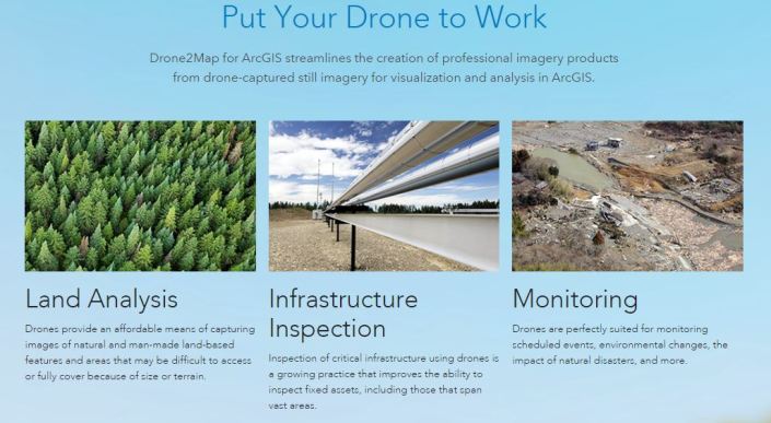
Together with many other capabilities in ArcGIS, Drone2Map helps you unlock the insights hidden in your imagery. As drones continue to revolutionize how we work today, Esri can help your organization gain the benefits of this emerging technology.
2D mapping
Create high resolutions ortho-mosaics, digital surface models, and multispectral indices.
Download sample data for 2D mapping

3D mapping
Create detailed 3D colorized point clouds, 3D textured meshes, and 3D PDFs.
Download sample data for 3D mapping
Drone2Map detects your camera and sensor parameters and intelligently applies the right defaults to turn your imagery into stunning information products inside ArcGIS, where they are useful immediately. You can also do in-field rapid processing of your drone-captured imagery to make sure you captured what you need, avoiding costly return trips.
